This site is located a few miles further on Pleasant Park Rd outside of Conifer, CO
If anyone has any idea where this cemetery is located or how to get access to it, I would be greatly appreciative. It is well documented in a number of books or sites, but everything around it looks to be private property and I could not find any access roads...
Saturday, January 8, 2011
Conifer Cemetery (39-31.033N, 105-18.245W)
Overall: Right off of 285 on Pleasant Park Road, looks as though there is some very recent restoration activity with the surveyors tape on many markers and temporary markers.
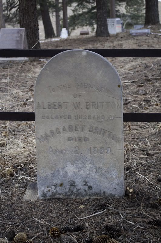
Oldest Grave: Albert Britton, April 2 1889; Gravestone
Photos: Pictures on Photobucket
Observations: For being right off 285 and pretty obvious, this cemetery has not been used much recently - newest marker is 2005. There is definitely some restoration work going on.
findagrave.com has a decent amount of information on a lot of the Kemps and McQueary's in the location. There are also a lot of Wheelers and Jones in the place.
Nothing too out of the ordinary, just a cemetery that may or may not be currently used. As with most sites around here, many unmarked graves that look to be trying to be located and restored.
Further Research: With the restoration and proximity to our house, we'll definitely check back from time to time to see what the restoration gets accomplished.
Wamblee Valley Memorial Park (39-27.701N, 105-19.604W)
Overall: This site is not in too many references anywhere that I could find. I found it by luck looking at a USGS Topographical Map of the area. A touch of research on Google and Jefferson Country site identifies this as "French Canadian."
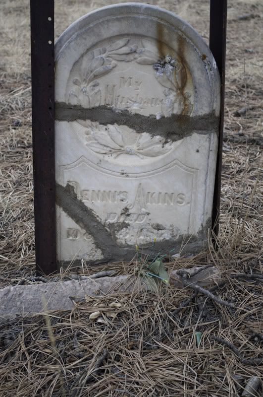
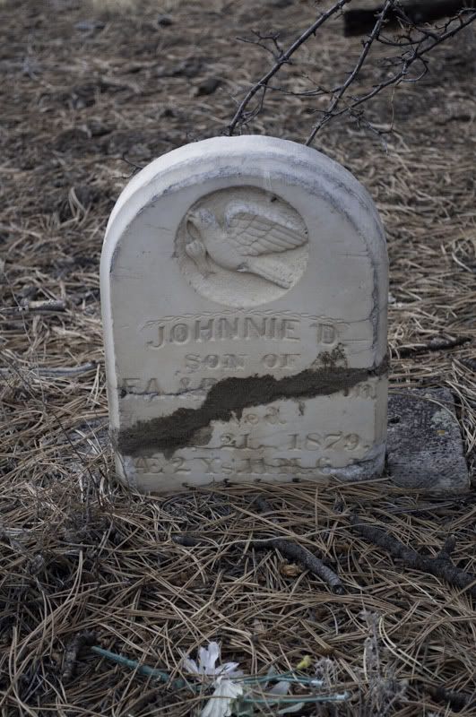
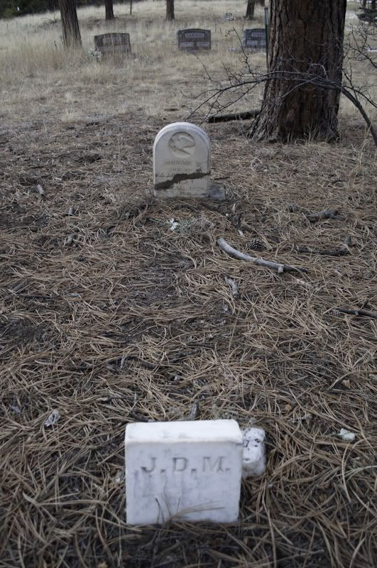
Oldest Grave: Two restored markers are tough to read, but both look to be from 1879: Dennis Akins and Johnnie D. M. (found the M on the small foot marker) ; Akins Gravestone ; Johnnie M Grave Marker; Johnnie M Gravestone with Footer
Photos: Pictures on Photobucket
Observations: This was a very strange find. At the very end of a mountain road - sandwiched between two houses and some private land. To find the site, travel on 285 to south of Conifer, get off at Richmond Hill Road and follow it into the hills, about a mile in you will get to a T in the road, take a right (Wamblee Valley Rd), take this for about 2.5 miles and you will come to a Y in the road, to the right is clearly marked as a private drive and to the left is Memorial Park Way - take this left and just down from there the road ends and there is the site.
There were only a handful of marked graves, but lots and lots of markers (metal and wooden) from what appears to be a restoration project. However, that restoration does not look to be very recent.
This site just looks like a place that time forgot. Not too may people live down Wamblee Valley Road, so the site probably is only seen by a few people a year.
Further Research: I am definitely going to do some more research on this site, very little is marked with lots of temporary markers. It also looks like it is from near the beginning of the gold rush (oldest markers were 1879, but only a handful in the 1800's, so most of those are probably the unmarked).
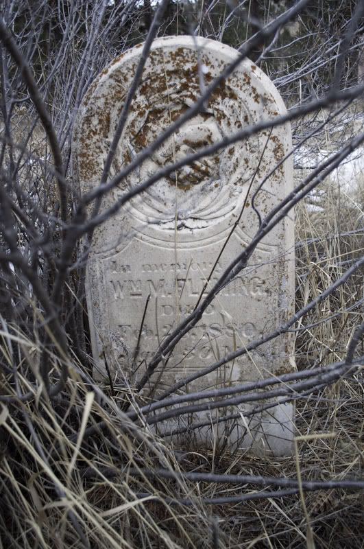
Pine Gulch Cemetery (39-27.658N, 105-23.853W)
Overall: Could not believe this is pretty much right in our backyard - fairly small and does not appear to still be in use.
Oldest Grave: William M. Fleming, 1880 ; Gravestone
Photos: Pictures on Photobucket
Observations: As indicated before, this is pretty much in our backyard. As with most cemeteries in Colorado that date to the Gold Rush time, it does not appear that all of the graves are marked. Those that are there are in decent shape.
Not a whole lot to say about this one - just kind of there and more interesting for us being close to us.
I'd say we have at least found on the map at least 7 cemeteries within about 10 miles of us.
Further Research: Does not appear there is any active restoration going on, but due to proximity may check back from time to time...
Wednesday, January 5, 2011
Updates
Haven't had an update in a while - one reason is we have not gotten a chance to get out much more after Como and Mt. Sherman.
However, I have started doing a bit more research and looking for more out of the way place that maybe do not get the press and photos such as the Dauntless Mine on Mt. Sherman. Don't get me wrong, that Mine may be my favorite site so far - but pretty much everyone takes pictures of it... One interesting tidbit I just found out - looks like up until at least the end of 2008 there was an additional building on the site that seems to have come down in the past couple of years.
My desire will be to do more research this winter and when spring and summer 2011 comes around, begin exploring again - only this time, looking for more out of the way places - something we will have to get a jeep or ATV for...
Monday, September 6, 2010
Como and Mount Sherman
Been a while since I last posted, but that is not to say we have not been Ghost Town and Cemetery hunting!
One new site on Mt. Sherman, can't tell for sure, but it might be the Dauntless Mine. It is a very easy hike up from the gate at the end of the road. I was very intrigued by the site - the mine is obviously gated and locked, but looks as though there is some activity up there recently. Lots of artifacts, some looking a bit newer than others - the mine was likely first there in the late 1800s, yet there is an old car and truck - don't think that was original...
Pictures at: Pictures on Photobucket
August 21, 2010 was the Boreas Pass Railroad Days and not only was there excellent information and slide show (yes, an slide show with film slides and not just a Powerpoint) about the railroad, but the Roundhouse was open for tours. Not a whole lot to say about this, it was just some great pictures and discussions.
Pictures at: Pictures on Photobucket/
Monday, July 12, 2010
Visited Ghost Towns
We visited a number of "Ghost Towns" at the same time as the below cemeteries, here are a few comments on them.
Overall, many of the so called Ghost Towns that are located near towns do have a significant amount of history, but are lacking in what we feel is a true Ghost Town. Our definition of a Ghost Town is a site that has been abandoned for many decades and still has the original buildings in their original shape - not refurbished.
Don't get us wrong, we very much appreciate and honor those who have taken the time to restore the old buildings and document the history of a town or area, such as Como, but they are not in our true definition of a Ghost Town.
Como: Ricky and others are doing an excellent job of restoring the old buildings, including the roundhouse. There are many original buildings, some still in rough shape - but what they are doing in Como is restoring the old buildings and really acknowledging the history of the area.
Boreas Pass: At the top of Boreas Pass are some refurbished buildings and also an old train car. The original purpose of the road to the pass was a railroad, so there are some artifacts still remaining at the pass. We recommend when first passing through Como to visit the Mountain Man Gallery and pick up a Boreas Pass brochure, which will give insight into the wagon wheel numbers along the side of the road up to the pass.
Park City: Some older buildings exist, but have been restored. When coming into town, take a look to the right, nestled back on the hill is what appears to be an old mine - we did not venture to the building, looked like private property from the road to the building.
Alma Junction: Some old row houses along County Road 12 about a mile off Highway 9 - interesting, but nothing much more to say about them.
Redstone: Has been completely restored and it looked to us to be a vacation spot for wealthy Denver suburbanites. Definitely a lot of history in the town, but not much in terms of our definition of a Ghost Town, except.... The most obvious feature of the Redstone area is the remains of the Coal Kilns on the side of the road before you turn off 133 to go into Redstone. There appear to be a lot of original looks to the kilns, but at the same time, some of the kilns are closed off with cement cinder blocks - not sure those were around in the late 1800's... Also, look at the kilns on the side of the driveway back to the stables - looks as though a number of them were destroyed when putting in the driveway. One last word, the front kilns are roped off, so you cannot get close, but there are kilns behind those and you might get a better look at those.
Redstone Pictures
Marble: Although this too is not much of a Ghost Town, a VERY interesting place to visit. Just to look at all of the marble in the river is amazing. It looks as though they are again mining marble from the quarry. We got to Marble late in the day and the road to the quarry was blocked, so we could not visit that nor could we go to the museum to talk to anyone about the area. One cool thing was a marble symposium going on near the river (about a mile in from the town limits) - a number of artists from around the world (saw one lady from London, England) were sculpting in, what else, marble. The area looks to be a permanent location for this type of thing, electrical and air connections were permanent in the ground. So if you visit the area, look for that location, there may be some sculpting going on.
Marble Pictures
Crystal: When you continue through Marble you can go to Crystal, which from all accounts, looked to be a true Ghost Town. One minor problem - there is a sign on the road that says 4 wheel drive vehicles only - heed that sign... We did not have a 4x4 and made it about a mile in and thought better of it... We did find a marble shop in Marble that appears to do jeep tours into Crystal, but alas, because it was late in the day, the shop was closed.
Independence: This is a true Ghost Town despite being restored by, I believe, the Aspen Historical Society. Pictures and a separate blog post will follow on this...
Independence Pictures
Subscribe to:
Posts (Atom)